EDUTEK INSTRUMENTATION
GST : 06AEWPJ6896D1ZU

call images

Call us

07313726362

Positioning Electronic Total Station

Positioning Electronic Total Station

Price 5500.0 INR/ Unit

MOQ : 1 Unit

Positioning Electronic Total Station Specification

  • Usage
  • Critical for ETS Setup: Provides precise leveling and forced centering over a survey point
  • Operate Method
  • Manual: Three Leveling Screws for precise adjustment; Lock/Clamp lever for securing to a tripod
  • Application
  • Land Surveying, Civil Engineering, Construction, Total Station Setup
  • Classification
  • Surveying Accessory / Geodetic Equipment
  • Material
  • Aluminum Alloy or Brass, Steel (Leveling Screws)
  • Product Type
  • Tribrach / Prism Adapter
  • Weight
  • 500-800 Grams (g)
  • Dimension (L*W*H)
  • 160x140x100 Millimeter (mm)
  • Color
  • Green (Main Body), Black (Knobs)
  • Battery Type
  • Rechargeable Lithium-Ion
  • Distance Measurement Range
  • Up to 5000m (with prism)
  • Interface
  • RS232C, USB, Bluetooth
  • Usage
  • Land Surveying, Construction, Engineering measurement
  • Continuous Operation Time
  • Approx. 8 hours
  • Data Storage
  • Internal memory + External USB support
  • Operating Temperature
  • -20C to +50C
  • IP Rating
  • IP55 Dust & Water Resistant
  • Angle Measurement
  • 1\\
  • Magnification
  • 30x
  • Compensator
  • Dual-axis compensator
  • Laser Plummet
  • Yes
  • Display
  • Dual side LCD with backlight
  • Power Supply
  • 7.4V/3400mAh Li-Ion Battery
  • Product Type
  • Positioning Electronic Total Station
  • Weight
  • Approx. 5.5 kg
 

Positioning Electronic Total Station Trade Information

  • Minimum Order Quantity
  • 1 Unit
  • Payment Terms
  • Cheque, Telegraphic Transfer (T/T), Letter of Credit (L/C), Cash Advance (CA), Cash in Advance (CID)
  • Sample Available
  • Yes
  • Sample Policy
  • Sample costs shipping and taxes has to be paid by the buyer
  • Packaging Details
  • carton box, export quality also available
  • Main Export Market(s)
  • Asia, Eastern Europe, Western Europe, Middle East, Africa
  • Main Domestic Market
  • All India
  • Certifications
  • ISO 9001, 14001 ,CE
 

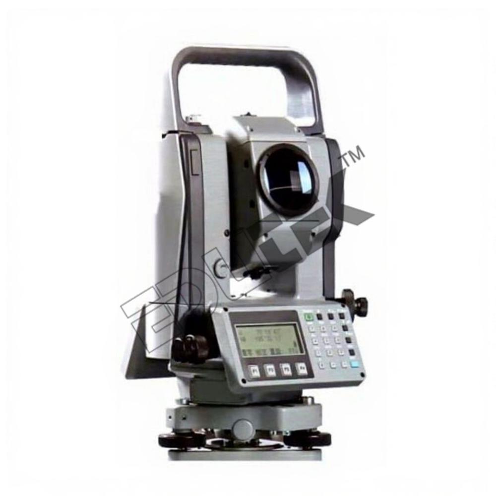
About Positioning Electronic Total Station

Positioning Electronic Total Station

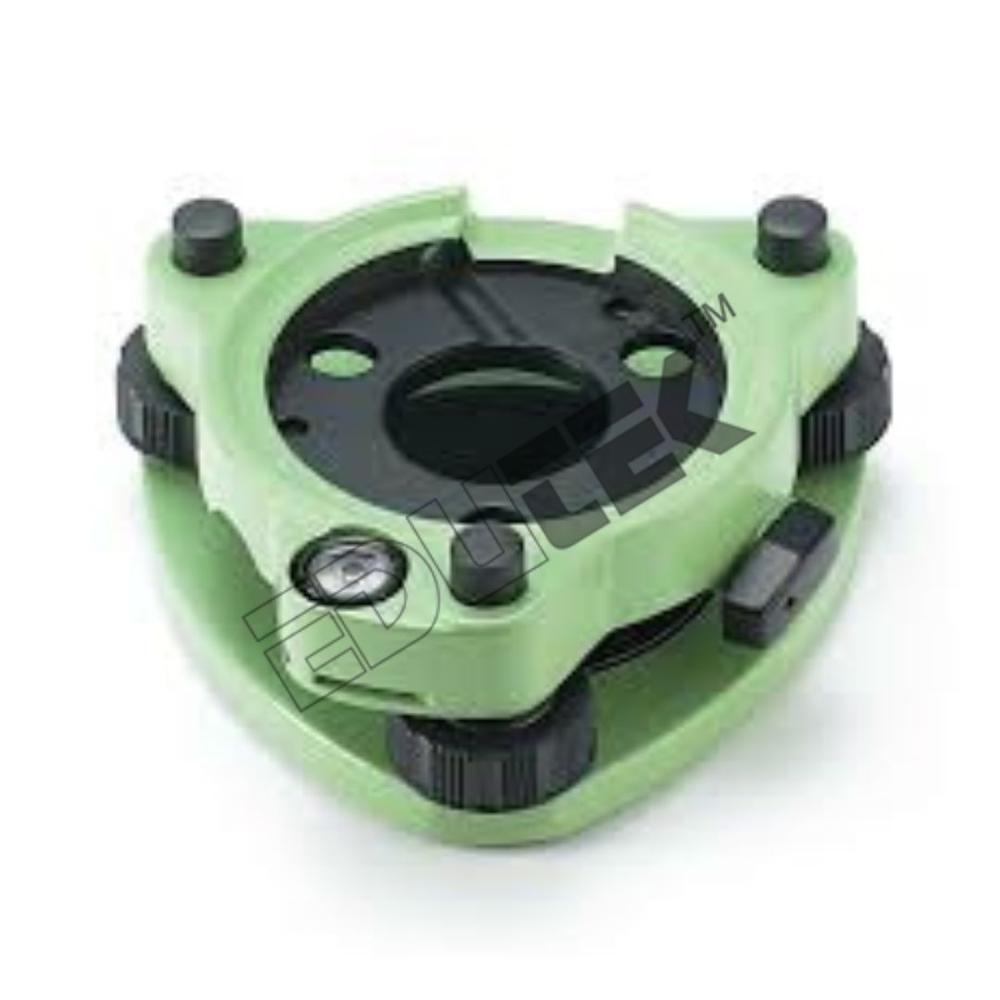
Accessories offered:
  • Battery
  • Battery charger
  • Tool kit with case
  • Field of view : 1o30'
  • Least Count : 1"
  • Accuracy : 2"
  • Prism : 2000 M
  • Distance Accuracy : +( 2mm + 2 ppm ) X D
  • Display : Two Side(Graphics LCD - 24 Alpha Num Keys)
  • Internal Memory : 24000 Points
  • Single Prism Assembly : Single Prism 1 No.
  • Prism Holder SIN-Tilt 3 1 No.
  • Prism Pole with bubble 1 No.
  • Downloading software with F-4 data transfer cable 1 No.
  • Wooden Tripod 1 No

Exceptional Measurement Capabilities
This electronic total station delivers unprecedented precision, measuring distances up to 5000 meters with prism support and offering selectable angle accuracy of 1" or 5". It integrates a dual-axis compensator and laser plummet, ensuring reliable alignment and accuracy even in demanding field conditions. These features make it an optimal solution for tasks requiring meticulous data acquisition and point positioning.


User-Friendly Interface and Data Management
Equipped with dual side LCD displays featuring backlighting, this device ensures clear readings in diverse lighting situations. The total station supports both internal memory and external USB, making data storage and transfer efficient. Multiple connectivity options, including RS232C, USB, and Bluetooth, enable smooth integration into existing workflows and simplify data exchange.


Durability and Operational Reliability
Designed to withstand rigorous environments, the total station operates efficiently within -20C to +50C and boasts an IP55 rating for dust and water resistance. Its rechargeable lithium-ion battery allows for approximately eight hours of uninterrupted use, making it ideal for extended field operations. At around 5.5 kg, the device balances robust construction with manageable portability.

FAQs of Positioning Electronic Total Station:


Q: How is the Positioning Electronic Total Station used in land surveying and construction projects?

A: The total station is operated at survey sites to measure distances and angles with high accuracy, using its 30x magnification telescope and up to 5000m distance range with a prism. It helps precisely position and document reference points, making it invaluable for boundary marking, site layout, and engineering measurements.

Q: What advantages does the dual-axis compensator offer during field measurements?

A: The dual-axis compensator automatically corrects tilt errors in both horizontal and vertical axes, ensuring accurate measurement results even on uneven terrain. This feature greatly enhances reliability and reduces the potential for manual leveling mistakes.

Q: When is data stored during the measurement process, and how can it be accessed?

A: Measured data is stored instantly in the stations internal memory and can also be transferred to external USB devices. Users can access or export data as needed using RS232C, USB, or Bluetooth interfaces, supporting efficient post-processing and reporting.

Q: Where can this total station be safely operated given environmental conditions?

A: With an operating temperature range of -20C to +50C and IP55 dust and water resistance, the device is suitable for use in a variety of outdoor settings, from construction sites to remote survey locations, even in inclement weather.

Q: What is the process for maintaining continuous operation during long surveying sessions?

A: Continuous operation is maintained by utilizing its rechargeable 7.4V/3400mAh lithium-ion battery, which provides about eight hours of field use. Spare batteries or external charging options can further extend operational time on extended missions.

Q: How does the laser plummet assist users during setup?

A: The built-in laser plummet allows users to quickly and accurately center the instrument over ground points, streamlining setup and reducing errors during initial positioning.

Q: What are the primary benefits of purchasing this total station from an exporter, manufacturer, or supplier in India?

A: Sourcing from India ensures direct access to specialized support, competitive pricing, and high-quality manufacturing. Exporters and suppliers can provide tailored solutions to meet varied project needs and offer rapid delivery and after-sales service across different regions.

Tell us about your requirement
product

Price:

Quantity
Select Unit

  • 50
  • 100
  • 200
  • 250
  • 500
  • 1000+
Additional detail
Mobile number

Email

More Products in Surveying Instruments Category

Tangent Clinometer

Tangent Clinometer

Price 1600.0 INR / Piece

Minimum Order Quantity : 1 Piece

Application : Physics Lab, Engineering Workshop, Metrology Training, Measurement Demonstrations

Classification : Measurement & Metrology Training Equipment

Operate Method : Manual Vernier Adjustment with Sliding Beam

Usage : Used to demonstrate precision linear measurement, height measurement, and calibration principles in labs

Dumpy Level .

Dumpy Level .

Price 1400.0 INR / Unit

Minimum Order Quantity : 1 Unit

Application : Civil Engineering, Construction, Land Surveying, Grading, Site Layout, Monitoring

Classification : Surveying Instrument / Geodetic Equipment

Operate Method : Manual Leveling: Using leveling screws and a Bubble Vial (or an Automatic Compensator in modern versions) to establish horizontal sight

Usage : Establishing a horizontal line of sight for measuring height differences (elevations)

Ranging Rod

Ranging Rod

Price 300.0 INR / Piece

Minimum Order Quantity : 2 Pieces

Application : Chain Surveying, Establishing Straight Lines, Marking Survey Stations, Laying out Construction Sites

Classification : Surveying Accessory / Line of Sight Marker

Operate Method : Manual: Driven or held vertically into the ground over a survey point; its bright colors make it visible over long distances

Usage : Marking the position of stations and terminals, and for lining in intermediate points during chain or tape surveying

Tribrach Surveying Instrument

Tribrach Surveying Instrument

Price 1000.0 INR / Unit

Minimum Order Quantity : 1 Unit

Application : Land Surveying, Civil Engineering, Construction, Monitoring, Total Station Setup

Classification : Surveying Accessory / Geodetic Equipment

Operate Method : Manual: Three Leveling Screws for adjustment; Lock/Clamp lever for securing to a tripod head

Usage : Attaching a surveying instrument to a tripod; Precise leveling and forced centering over a survey point


"We deal all over World but our main domestic market is South India"
Back to top